Glyndwr Walkway
I have been planning to walk this route for several years but Covid and a family illness intervened. Now in August 2021, I am attempting the walk, camping along the way. I have decided to use this walk as a fund raising opportunity for two charities: Bowel Cancer UK and Small Steps for Sienna. Please see my email for further details these.
I have posted a daily blog of this walk on Facebook, (https://www.facebook.com/lewis.griffiths.739/) where there are also more photos to be found. But not all of you use Facebook (or what Private Eye calls Fakeook!) and I didn't want you to miss out.
Please consider supporting me in my endeavours to raise funds for these two deserving causes.
Day 1:

I set off from Knighton about 7.30 in the morning, well hydrated from the consumption of several excellent ales from Watson’s Alehouse, the previous evening. The marker showing the beginning of the Glyndwr walkway is literally outside the door of this establishment. Weaving my way through the back streets of Knighton in the early morning was a navigational challenge, which was not aided by losing a contact lens within the first hundred metres! I had to unpack most of my rucksack, In search of a spare.
Walking conditions were ideal with high cloud and a gentle breeze. I walked steadily up into some beautiful green hills which involved several steep climbs and there were times when I was already wondering what else I could take out of my pack. I chatted briefly with a Shepherd who is having a good year, as the countryside is green and the lambs are growing and selling well. Llangunlo did not detain me long and it started raining heavily as I made my way up to Beacon Hill. The wind also got up, conditions were not at all pleasant. And that is the way it remained for the rest of the day. As I walked towards my evening’s destination a group of windmills appeared out of the cloud and provided a pleasing change of view. I was lucky in that Brandy Hill had a vacant campsite and I was able to pitch my tent, in the rain, eat a dehydrated meal and settle down for the night. Eventually it stopped raining. I
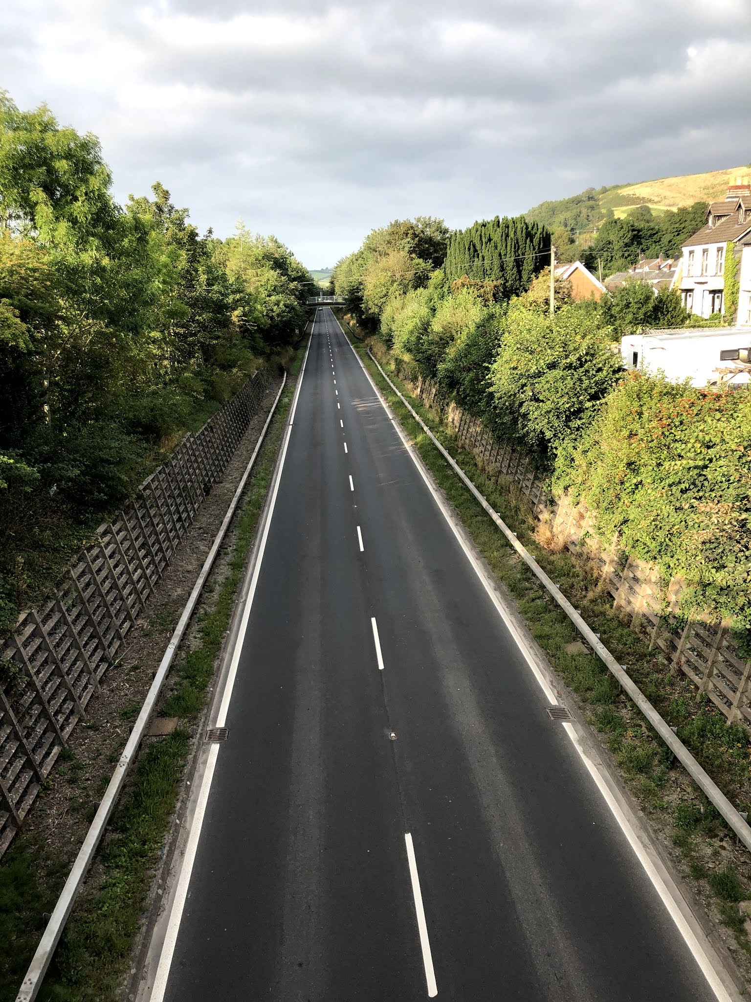
saw no one for most of the day, and met no walkers. This is not a very busy trail!
Day 2:

I slept fairly well despite the presence of a Tawny owl in the ash tree above me: he kept calling me a “ twit” and he may have had a point! It had stopped raining and I breakfasted on coffee and crumbs while the tent dried a little. I was packed and on the road by 8 am climbing up towards the windmills, through a farmyard where a collie dog charged me a little too aggressively. I had my sturdy stick in hand but luckily the farmer called him off and I didn’t have to use it.
The route passed really close to the Windmill farm and it was fascinating to be so close to these giant machines. The walking was fairly easy through Upland moor and grassland before descending to Llanbadarn Ffynydd. There is some serious farming going on in this area with what looks like several large pig farms as well as some excellent pasture with plantain and chicory (I think) being grown. I failed to find the Village shop to top up my supplies and the pub looked very closed. I phoned ahead and managed to book a campsite at Abbeycwnhir.
The afternoon saw me walking up over hill land with extensive views. It was sunny and there was a gentle breeze. I dropped my pack and walked the short distance up to the trig point on Ysgwf Ford and could see the Brecon Beacons to the south and what might have been the beginnings of Snowdonia in the the northern clouds. The long steady descent passed through some grass hill land and I managed to get a little bit lost but following well worn sheep tracks! Luckily I soon recovered to make it into a lovely village of Abbycwmhir by 5 pm..
My campsite was in the grounds of the ruined Abby where most of the remains of Prince Llewellyn ap Gruffyd are believed to have been buried. There is a late slab which commemorates the memory of the great Welsh leader and this was a beautiful and memorable place to camp. Owen Glyndwr was less impressed as he attacked the Abbey in 1401,as he suspected the monks were holding English sympathies.
Most of Llewellyn’s remains were buried here because his head, of course, remained on a spike outside the Tower for many years.
Day 3:


The wind changed in the night and my sheltered spot was subjected to several heavy schools of wind and rain. However it cleared by the morning and after a breakfast of coffee and a nut bar I was soon on my way by 7.00. Food supplies are running a little low. buggy’s guide book told me of a cafe in the next village and I was dreaming of bacon and eggs as I climbed up through pretty woodland to the top. I had a chat with a farmer who was busy weaning lambs. He was interested in New Zealand but hadn’t been “off the farm”. He must have been 70. “It’s just impossible to find anyone to help me” he complained “people just don’t want to work anymore!”
The cafe at Bwlch y Sarnau was Covid closed. There was nowhere else to buy food so I pressed on trying to think positively about the four day old cheese and broken oat cakes which were now my lunch. Much of the next few hours involved road walking and quite a lot of ascent and descent: both were quite hard on my long suffering feet but the views were stunning and some pleasant sunny weather with just enough breeze more than compensated.
Llanidloes did not seem to be getting any nearer but eventually I turned onto the road outside New Chapel and began the home stretch. I must’ve missed a marker sign instead of turning left. I headed steadily downhill on the road that I thought was leading to the town. Eventually I hit the main road into the town, the A483, and had to turn left and walk too many miles along busy verges as cars and lorries rushed past my aching feet. The road edge was rutted and walking was not at all easy. It was not a pleasant way to end a great day’s walking but the Pint that awaited me inside the Red Lion hotel made all seem well again. I had arranged to stay here tonight - a hot shower and extra dinner make the world a wonderful place once more!
Day 4:

I couldn’t miss out on the hotel breakfast so I hatched a plan to miss part of the track instead. I was able to stock up on supplies and eventually got a taxi out to Cwmbiga to start the next section. This means I will have a 10 mile section to complete next month but it has eased the logistics considerably. I set off through a forest path with occasional views of Llyn Clywedog. A few missing marker signs confused the route for a while which led steeply through farm land to the distant foot hills of Plynlimmon. The boggy moorland suddenly developed a suspiciously straight road with a slate bedrock base. The remains of a mall Roman fort on the slopes of Penychrocben provided explanation. What a lonely place to be a shivering centurion.
There was no alternative to camping so I trudged on a little further to the shores of the isolated small lake, Glaslyn. I had collected a few field mushrooms and my ham, chorizo and mushroom risotto was fantastic. This is a very isolated but beautiful location.
Day 5:

While brewing coffee this morning, I realised I was having a conversation with my trusty stick, “Sticky Mcsticky! I’m not sure if this is a worrying development ( he didn’t reply) ,so having made a couple of sandwiches for lunch, I quickly set off to the highest point on the walk, on the shoulder of Foel Fadiau, just over 500 metres. It was quite misty and the views towards Plynlimmon were disappointing as I began the first of several steep descents for the day. With a deep ravine on my left, that would eventually become the Dyfi Valley, I strode gamely on through heavy drizzle, encountering several steep climbs amongst the descent to the near sea level town of Machynlleth. I arrived at the hotel and wondered what the strange aroma in reception was: until I realised it was me. Wet feet all day had not helped and I have lost m other pair! The solution - quickly wash them and walk down to the restaurant nonchalantly- in wet socks! Tomorrow is a rest day and the hot bath and excellent steak that awaited me at the Wynnstay Arms was great, the extensive Italian wine list was an unexpected bonus.
So five days of walking and a distance of around 110 kilometers and having climbed 3,500 metres, carrying a pack that (with wet tent and water included) has weighed up to 14kg, I think I deserve a day off in Machynlleth, which is where Owen held his Parliament and was crowned Prince of Wales in 1404.
Day 6/7
Oh the sheer bliss of a comfy bed followed by an excellent cooked breakfast! The plan was to wonder around Machynlleth (not that that would take very long!) and purchase a few essential supplies like boot laces, new socks and cheese. The weight of a wet tent, sleeping bag and cooking stove is definitely slowing me down so last night I managed to arrange B&B for the rest of the trip: I am able to leave about 7kg of camping gear at this hotel! Yee-haa!
I managed most of my purchases and discovered a milk vending machine that dispensed the best chocolate milkshake ever and some excellent Brie like cheese. Check it out next time you are passing! (https://llaethjenkinsmilk.co.uk/en_gb/)
Later, I dined on Welsh lamb but rather reluctantly had to settle for a large glass of wine and an early night.
 After another fine breakfast (which wisely I dissected to produce a bacon sandwich for morning tea,) I set off briskly down the road towards the nearby village Forge: now that I am carrying half the previous weight I feel like I am floating and could leap over small buildings with ease! The climbing began at Forge, gently at first, with intermittent descents until a steep climb, at times through waist high bracken, along the slopes of Cefn Coch. By now it was raining heavily and the wind was gusting quite strongly. No hope of staying dry, so just stay warm. I had lunch having descended to the civilisation of Cemaes Road and then climbed back up around Pen-y-gyrn to eventually reach 400 metres, with no change in weather conditions.
Eventually I could see the little village of Llanbrynmair below me but the approach was very confused, with a dilapidated sign attempted to indicate a change of route; my phone was indicating somewhere else and there was not a marker post in sight. I did the best I could but ended up trespassing through a small gate across a garden, apologising profusely to the slightly irate looking owner who questioned my route.

This has been a long slog today, not helped by the weather and too much black pudding and sausage at the start; still 16 miles (25.5 km) were covered and 850 metres was climbed. Thankfully The Wynnstay Arms was at hand. At first impression this appeared to be the pub time had forgotten but the beer was excellent, the landlady Pauline (who looked younger than me but told me she was over 80!) rustled up a roast beef dinner from somewhere and provided newspaper and heat to dry my soaking boots. As the bar slowly filled with locals I forced myself to sneak away - tomorrow is the longest day on this trail and a hangover would help not at all!
Day 8

I was up at six and out by half past with my damp socks gently moistening my nice dry boots. This was to be the longest day and the sky looked promising as I set off. I hadn’t had the heart to get Pauline out of bed to cook me breakfast, (she did offer) but I settled for two nut bars and an instant coffee. As I retraced my steps under the impressive railway bridge, the route that I should have taken last night was quite obvious in the clear light of a new morning. I turned right up the Cerrig y Tan ridge and began to climb steeply. Today is 29km (18miles) and I must confess to being a little apprehensive. Later the route snaked its way through some forestry, which made for a pleasant change from all the exposed moorland. Then back onto some high farm land where lambs were being weaned and bracken was being topped.
This was where tragedy struck! My faithful companion, Sticky MacSticky, broke a thumb! And it was all my fault as he fell into a gate I was clumsily opening. I placed the pieces in my pocket vowing to glue him back together when we finish. He didn’t even cry: he is a very stoic stick.
Lunch seemed to come quite quickly and I dined well on the ripening Machynlleth cheese and salami, followed by fruit and nut chocolate. The view over to Pen Coed was impressive but slightly daunting, as another significant climb was involved. On my right I could clearly see the remains of the Iron Age hill-fort, Moel Ddolwen; it is incredible to think that people were already farming these ancient lands several thousand years ago. Somewhere on Pen Coed I completely lost the trail as I waded through shoulder high bracken but it was dry and the sun was shining and I didn’t really care. I picked it up gain half a mile further on having tiptoed across a sphagnum bog.
The end of the route involved a descent though ancient woodland, which included a boulder strewn path which might once have been an ancient trail but which was now very slippery; what a great place to twist an ankle! There was also a final 100 meter climb through forestry and I have to confess to grinding that one out. It was a great relief to see the dam at Lake Vyrnwy come into view and realise that my B&B was only a few hundred meters away! Strangely, I think I finished today fresher than yesterday. Must have been the impact of the chocolate?
This dam is a Victorian effort, building commenced in 1882 and the village of Llanwddyn was drowned in the construction, but being nice Victorians they just built another one down stream. They weren’t so polite in later years! Cofiwch Dryweryn (https://en.wikipedia.org/wiki/Cofiwch_Dryweryn)
Pauline and David at Dam View Cottage were officially closed! Having had guests every night since Easter they were trying to grab a few days off but they very kindly re-opened for me. There are few B&B options in Llanwddyn and my only other alternative was to keep lugging the camping gear. So thanks both and the lamb shank dinner, followed by strawberries and cream, that appeared in front of me an hour or so later was fantastic. Stay here if you are tramping past folks!
Day 9

I think this was the first morning I awoke knowing that I would complete the walk! I have broken the back of it now. Only 24 km and 445meters of climbing today. After an excellent breakfast and the inevitable sluggish start that ensued, which included a quick view the dam, I was pleased to find a gentle route following the Afon Efyrnwy downstream before I encountered a steady climb through a forest trail along Yr All Boeth. The highest bracken of the entire route was growing well here, over 2 metres high. Bracken is becoming a problem on this higher ground as stocking rates are reduced. Over time, it may be part of a transition to woodland but it is a stubborn monoculture that does not encourage biodiversity and it doesn’t break down well. A forestry consultant told me that it emits as much methane as sheep and you can’t eat it! My daily “lose the trail -find the trail” game happened at Pont LLogel; there are many places where this is not an easy trail to navigate.
I was gaining some company this afternoon in that a friend, Claire, was in the area, had decided to meet me and walk part of the trail. We arranged a rendezvous at Dolanog for lunch. Dolanog is also famous for the Anne Griffiths chapel. Anne was apparently one of Wales’ most famous hymn writers and there is a fine brass plaque commemorating her efforts which, a little weirdly, has a brass slug crawling across it!
After a leisurely lunch Claire and I walked back through lovely woodland and gentle pastures to Meifod. She was not impressed when I kept telling here it was the easiest part of the entire walk. I didn’t even have to navigate as she already knew the route. An excellent steak and a glass or two of red made for a very sociable evening. It was very pleasant but a little strange to have company; I had to learn how to speak again after so many days of silence. Claire was the first walker I have met on the trail in nine days!


So lo it dawned! The final day! And I have to admit to arising with a certain sluggishness, which might just have been induced by a drinking companion and a second bottle of red? Claire walked the first hour or so with around the rather ominously sounding Llyn Du (the Black Lake, in English) and then I was back on my own climbing steadily up towards Fron Las. (Climbing starts, Claire disappears - coincidence?)
The walk was mainly through farmland and some woodland until I found ‘the Big Forest”, which sounded like it might have come from a fairy tale! There was some steady climbing involved at times and I seem to have lost a little energy. It may be the wine, it may be the fact that this is the shortest day or it may just be that I don’t want this to end? A few miles down the road lies journey’s end, at Welshpool. There will be people and trains and general busyness and I am not sure I am ready for that after all these days of silence and tranquility?
The route eventually skirted around a golf course and climbs up towards the final peak, marked by a trig point on Y Golfa, at 341 metres. There was a pretty fantastic view form here. To the east, just over the border, lay the Long Mynd, looking a little like a plasticine mountain that had been overstretched by an enthusiastic child. South of me lay Knighton, where the journey had begun and where Owain Glyndwr had won his first battle, helped it is said, by some mercenary Welsh archers who decided to forgo their wages and swap sides last minute! To the west, out of my view, lay Machynlleth, where I had rested and Owain had held his parliaments. A little further north of there lies Harlech Castle, one of the first to fall to Owain’s sword as his men marched to glory! And due north I could just make out the grey shapes of the Berwyns and maybe some the mighty peaks of Snowdonia that lay beyond. In my mind’s eye I could see the entire route stretching out, punctuated with little snapshots of my favourite bits, because, to be honest, a lot of it remains a blurred landscape; it is impossible to remember all of the detail.
After that it was a bit of a downer! The route should, I think, end at the trig point. What followed was a gentle descent on roads, through parkland and Welshpool suburbia until I found myself trudging up High Street looking for the marker that ends the route. It sits, almost apologetically, in a small park, in which a bunch of teenagers were noisily consuming cans of cider. A passing lady, walking some mutant breed of dog, took my final snapshot and it was over!
I had booked into the Royal Oak for the night, thinking it sounded like a cheery pub. It turned out to be the smartest hotel in Welshpool and I got a rather dubious look as I wandered into reception and sat down to take my boots off. Soon I was enjoying a hot shower and they didn’t throw me out of the dining room when I entered wearing grubby shorts, an All Black top and damp socks. And a mask of course, not obligatory but firmly recommended. They would probably have served me in my boxers as long as I entered wearing a mask?
I was looking forward to the railway journey back to west Wales, imagining myself reading the paper as the train rolled along the bucolic central Wales line. The reality was a hideously crowded train that arrived in Welshpool, full of Liverpool supporters who were already into their fifth “tinny”. I missed the central Wales line connection and had to go “the long way round” through Hereford, Newport, Cardiff and the scenic beauty of Port Talbot! Wearing a mask? You bet I was! It is mandatory on trains in Wales but across the border almost no-one was wearing one. I have just tested COVID negative for the third successive day!
The Wrap- Almost!

The walk is 135 miles (217km) long and climbs 6550 metres, descending about the same. While the walking is never technically difficult, the navigation, at times, posed a few issues. I started carrying about 15kg (including 2 litres of water and 2-3 days food.) Facilities along the way are variable and while it is possible to top up water supplies, I used Aquatabs, but the water in most streams out there is probably more drinkable that the stuff that comes out of your tap, in the wilder parts you cannot rely on buying food. I was down to 100grms of rice at one stage!
Once I lost the tent and cooking gear, yes even my coffee pot went, I was carrying about 9kg and could have reduced this further if I had used a day pack rather than continuing to use my main pack (3kg)
It was a challenge for an ageing, not fully fit but reasonably experienced walker. Indeed it was just about the right level of challenge for me. I could have completed it with the camping gear on board but it would have been a grind! As it was, I thoroughly enjoyed the experience - onwards and upwards from here!
Owain didn’t do so well in his later years. At the zenith of his power(1404-6) he ruled virtually the whole of Wales, in defiance of the English crown. He had the advantage of seizing power when his neighbours were starting a scrap that was to become the Wars of the Roses: Richard II was being deposed by Henry IV at the time. In later years he had the dubious privilege of honing the military skills of the next English King, Henry V, who marched on to a more famous victory at Agincourt. Ironically that battle was largely won by skilful deployment of the most fearsome weapon of the day - the longbow, in the hands of the best archers in the country - the Welsh!
But I digress. Owen ended up a fugitive. His manors were razed, his lands were confiscated. No-one really knows where or when he died; he may have become a monk. There is a Welsh legend that he is still out there, waiting for the next opportunity. If he is, I didn’t see him! He did have the honour of being voted, in 2003, as number 2 in the list of 100 Welsh heroes. Aneurin Bevan got the number one spot, Tom Jones came third!
Those of you who have read this entire blog (and thanks for sticking with me) will realise I haven’t actually completed the route. I missed a bit on entering Lanidloes and cheated with a taxi for a few miles out of that town so as to allow myself the luxury of a day off in Machynleth. So I have about nine miles left to got to join the southern end of the walk to the northern bit. I plan to do this on the first weekend in September and will post the final blog entry after that. In the meantime please share this widely and if you haven’t already donated something - please do. If you have - thank you very much.
Friday 3rd September
There was unfinished business that need attending to, the Llanidloes gap needing filling: it was nagging away at me like an aching tooth! I hadn’t actually completed the Glyndwr Way, I had just completed most of the Glyndwr Way. And so Friday morning found Fran and I driving north, under a gentle grey sky that threatened, but did not deliver rain.
We called in briefly at Abbey Cwm Hir, to pay our respects to Prince Llewellyn and buy a book I wasn’t prepared to carry away last time. It is a beautiful, peaceful valley; a fitting place for a warrior Prince to lie. Fran also appreciated the scenery and sanctity of this special place. After a brief chat with Anita, the owner, who was busily gardening but remembered me, (I don’t think many people camp here these days,) we moved on up the road towards Llanidloes. Fragments of the trail crossed the road, as we drove through Llanbrynmair and other places I had passed through.
“I walked across that ridge then down to the valley before climbing back up into the cloud and rain.” I enthused.
My companion smiled politely but was soon snoozing, as I drove on, experiencing flashbacks of the first few days of my walk.
She dropped me off at New Chapel. Those of you who have been with me on the entire journey may recall that I got horribly lost on the route into Llanidloes and ended up walking (staggering?) along a busy dual carriageway for a mile or two, too many. I don’t know how I missed the sign last time, it clearly instructed me to turn left down through a farm yard before climbing up through pleasant woodland and over a grassy hill. The town of Llanidloes soon hove into view and I particularly enjoyed crossing the footbridge over that bloody road. Fran had already checked into the Red Lion.( http://redlionllanidloes.com ) I arrived to a pint which was almost as welcome as the last time. It’s a friendly pub and of course they remembered the crazy old man who had staggered in a few weeks before. Another box had been ticked.
Saturday 4th September

I had about nine miles (c15Km) to walk today to complete the walk and so there was no urgency, particularly when Eileen, the landlady produced a gigantic cooked breakfast to help me on my way! So it was about ten as we drove out of Llanidloes towards the Llyn Clywedog reservoir, the starting point for my walk today. And Sticky Mac Sticky was repaired and rearing to go!

As this was a retrospective walk, I had decided to walk it retrospectively, which also meant I could conclude the entire project with a final pint at the Red Lion. Fran gamely started walking with me, but it was a steep climb from the beginning over sheep pasture, up to some forestry. She decided there was easier walking near the lake and turned around to enjoy her descent as I gamely plodded on, already regretting the second breakfast sausage.
The path soon descended through some forestry towards Llyn Clywedog, which was another dammed (damned?) Welsh valley, providing water to foreign lands. It is also a recreational facility and as I walked down towards one inlet I could see holding cages, presumably full of young trout, and about eight fishermen in little boats attempting to catch their parents. The path led down to the lakeside, except that it has been quite dry in these parts and the water levels are quite low.
“Huh! I thought.” as I crossed the footbridge over a muddy puddle, “I managed to walk through here last time, on the only wet day they’d had for weeks!”


The well nourished late start, and maybe a psychological approach that had decided I had already finished the walk, meant that I hadn’t been paying much attention to my pace, hydration or food intake. I had probably been rushing and I had to confess to beginning to feel a little tired! So when the walk descended into an old drover’s trail, lined with ancient oaks and hazel, I took the opportunity to sit down and rest a while, eating a left over nut bar and some stale salami I found in the rucksack. My bronzing wife, of course, had by now picnicked well on a selection of cheeses, charcuterie and fresh fruit, no doubt washed down by a fruity little wine! The view back across the valley to the village of Van compensated, even though two tall chimneys stood tall near the village; another reminder of its mining history.
A steady climb remained through farm land up to hill top that morphed into a golf course.
As I rounded the crest of the hill the first thing I noticed was the traffic noise from that bloody road again! The Saturday afternoon sounds of the town wafted up to me; in the distance someone scored a try on the rugby field; not long after I heard the line out call - in Welsh - pedwar… tri… saith, (5-3-7) - I couldn’t see who got the ball. The last part of the walk descended through an ancient beech forest and it was a lovely way for the walk to end, much nicer than the drudge down from the trig point in Welshpool. Near the end of the route, the Glyndwr Trail was joined by the Severn Way, a 224 mile walk following the longest of UK rivers, from the river’s source on Mt Plumlimmon, to Bristol. The forest ended abruptly onto a street and within a minute or so I had crossed the River Severn into Llanidloes and was enjoying another pint in the Red Lion.

And this one was certainly the best pint I have ever tasted - the walk was finally over ………. but The Severn Way sounds like a challenge?


.jpeg)

Comments
Post a Comment